Read the projects related to mapping urban and rural areas more analytically in chronological order :
Perfecture of Fthiodida - Public
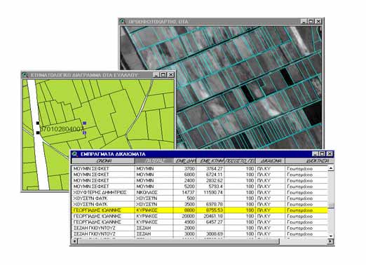
2008 : Agricultural Land Re distribution in the Municipality of Elatia in the prefecture of Fokida.
Project Description
The project includes detailed topographic mapping of agricultural land (4100000 m2) and re-distribution of parcels to achieve optimum cultivation conditions
Hellenic Ministry of Rural Development and Food
2010 : Study for the construction of a dam in Lutziakorma Stream.
Project description
Preparation of large scale detailed topographic maps.
Public : http://www.minagric.gr