Read the studies more analytically in chronological order:
OKXE (Organization of Cadastre and Mapping Greece) - public
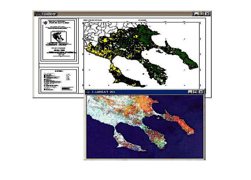
2004 : Quality Assessment of Land Use / land cover maps for the project CORINE LAND COVER 2000
Project Description
The derived Land use/cover maps of Corine 2000 project for Greece, were checked for compliance with the Corine nomenclature. Quality control was performed using higher accuracy thematic data as well as field surveys.
The project also includes geometric checking of horizontal accuracy of Ladsat.
Public : http://www.okxe.gr/
Eurostat European Commission
LUCAS 2009
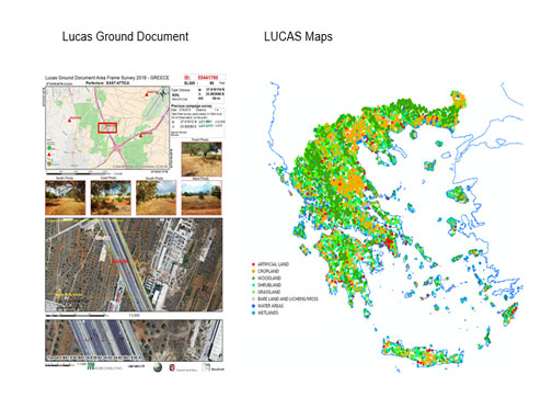
2009 : Land Use/Cover Area frame statistical Survey (LUCAS) 2009 – Agro-Environmental Survey: Field work in Greece, Italy and Slovenia.
Project description
LUCAS 2009 is a survey on the state and the dynamics of changes in land use and cover in the European Union. The LUCAS 2009 survey covers all 27 EU countries.
LUCAS 2015
2015 : Land Use/Cover Area frame statistical Survey (LUCAS) 2015 – Agro-Environmental Survey: Field work in Greece, Italy and Slovenia.
Project description
LUCAS 2015 is a survey on the state and the dynamics of changes in land use and cover in the European Union. The LUCAS 2015 survey covers all 27 EU countries.
2015 :Additional photo-interpretation of 13212 points under LUCAS 2015 (Cyprus, Greece, Malta and Slovenia).
Project description
Collection of statistical data on land use land, land cover, agro – environmental features and landscape using Photointerpretation techniques
LUCAS 2018
2018 : Land Use/Cover Area frame statistical Survey (LUCAS) 2018 – Agro-Environmental Survey: Field work in Cyprus,Greece, Italy, Italy and Slovenia and Croatia.
Project description
LUCAS 2018 is a survey on the state and the dynamics of changes in land use and cover in the European Union.